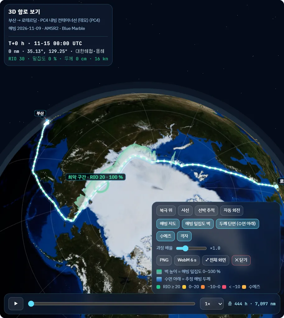
Open the Arctic route with sea-ice data.
POLARROUTE AI fuses daily sea-ice concentration, ice-thickness estimates, weather and vessel data, calculates the IMO POLARIS risk index for your ice class, and shows a safe, efficient route with speed and escort advice on one screen.
The problem
Sea ice moves every day; route decisions still rely on gut feel.
The Arctic route is shorter than Suez, yet the same route can turn risky in a day as the ice moves. Operations centres must pull scattered data together before every meeting.
Scattered data
Ice charts, weather forecasts, ice class and voyage plans sit in different places and are hard to compare at once.
Rules exist, calculation is tedious
IMO POLARIS asks for a risk index from ice type, concentration and ice class, but doing it by hand along a whole route is hard.
Suez comparison is hard
Few tools show, voyage by voyage and on the same basis, how much fuel, CO2 and time the Arctic route actually saves.
Product screens
POLARROUTE AI, in real screens.
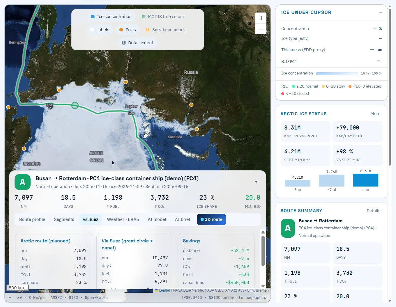
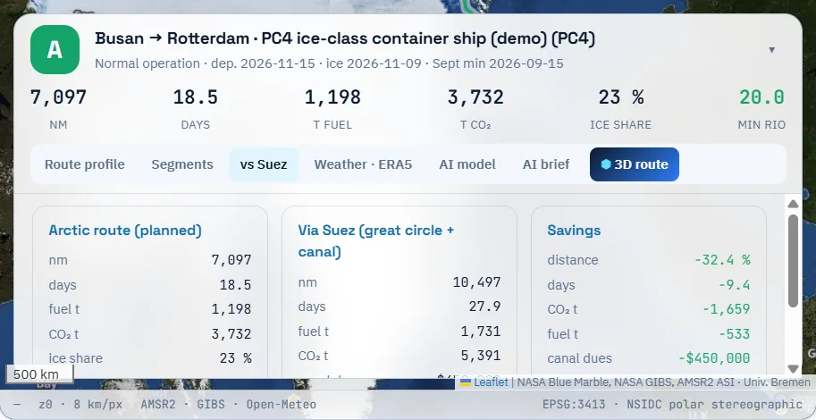
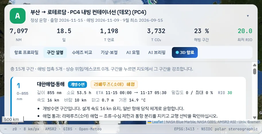
These are real screens from the demo account: an Arctic route from Busan to Rotterdam for a PC4 ice-class container ship (demo vessel).
Features
Everything you need before departure, on one screen.
See the ice, calculate the risk, find the route, compare with Suez and produce the briefing.
Route planning & POLARIS
Avoids closed cells and finds the best route at permitted speeds for your ice class.
Sea-ice data
Daily AMSR2 6.25 km concentration with ice type and thickness estimates.
Suez comparison, fuel & CO2
Distance, days, fuel, CO2 and canal dues side by side with Suez.
AI briefing & 3D route
Voyage brief in Korean and English, and the route on a 3D globe.
Fleet & voyages
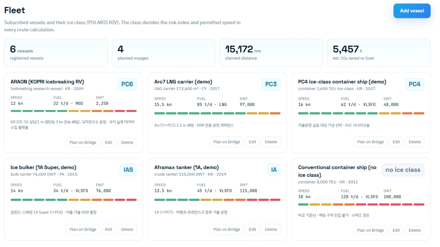
Register vessels, save voyages and recalculate on the latest ice field.
Data sources
Public data in use now, and field and AIS data to connect in a PoC.
How it works
From ice field to sailing advice, in four steps.
Enter the voyage
Pick origin and destination, ice class, departure date and ice-field date.
Fuse ice and weather
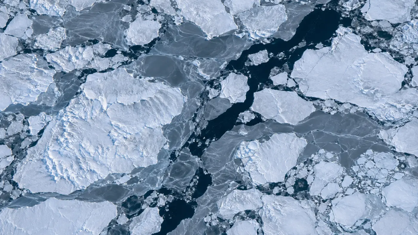
Estimate ice type and thickness from AMSR2 concentration and correct with ERA5 temperatures.
POLARIS and A*
Compute RIO for every cell, drop closed cells and search the best route at permitted speeds.
Advice and briefing
Share segment advice, the Suez comparison, an AI briefing and a 3D route.
Runs on public data today; field and operations data are added in a PoC
Who it is for
Built for teams that run ships in the Arctic.
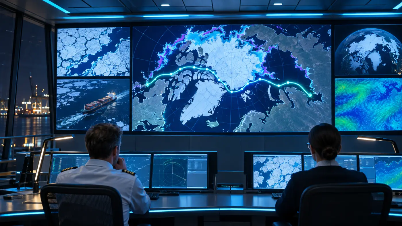
Shipping operations centres, polar research voyages and shipbuilders building smart ships use the same engine.
- Shipping operations centres: “can we go?” in numbers, every voyage
- Polar research voyages: safe access to sampling stations
- Shipbuilders & smart ships: route advice through an API
Why POLARROUTE AI
Not just an ice map: the reasons behind a sailing decision.
Ice charts and weather services remain essential references. POLARROUTE AI turns them into calculations for your ship class and voyage.
| Ice charts & maps | General weather routing | POLARROUTE AI | |
|---|---|---|---|
| Your ice class | User interprets | Usually generic ships | POLARIS RIO per ice class |
| Speed limits & closed areas | None | Usually none | Per-leg speed limits, closed cells |
| Optimal route | None | Weather-driven | Ice risk + distance + speed A* |
| Suez comparison | None | Sometimes | Distance, days, fuel, CO2, canal dues |
| What you share | Map images | Reports | AI briefing (KO/EN), 3D route |
General characteristics; products vary. POLARROUTE AI is a screening tool and does not replace ice charts, permits or the master’s judgement. Full comparison
Next step
Prove it on real voyages.
In a two-month PoC we plan to run one or two operators’ planned voyages, compare with polar field measurements, and check thickness and ETA errors.
Register fleet & voyages
Set up vessels and planned voyages with your operations rules.
Compare with measurements
Check thickness and ETA errors against field data and voyage records.
Field validation
Extend seasonal accuracy through field validation projects.
Subscription
Per-vessel subscriptions and operations-centre deployments.
Thickness MAE ≤ 20 cm
Ice-thickness estimate vs. field measurements (PoC target)
ETA error within 10%
Planned vs. actual arrival (PoC target)
Targets, not validated results. We will publish after validation.
The company
A team that runs AI in industrial settings.
POLARROUTE AI is built by MomentCube, an industrial AI company, combining field AI operations with satellite and sea-ice data.
3 lead R&D projects
Switchgear predictive maintenance, context-aware safety AI, Safety4Cut with NVIDIA.
3 granted patents
Industrial AI safety, autonomous equipment management, automatic reports.
Public-sector operations
AI fire and safety monitoring at Incheon Environmental Corporation.
Certified venture
Innovation-growth venture with a dedicated R&D unit.
FAQ
Frequently asked questions
What is POLARROUTE AI?
POLARROUTE AI is MomentCube’s Arctic route risk management SaaS. It fuses polar sea-ice concentration and thickness, polar weather and vessel data to deliver optimal routes and ice-avoidance advice for the Northern Sea Route and high-latitude waters on a subscription basis.
How does it use IMO POLARIS?
Following IMO MSC.1/Circ.1519, it multiplies the concentration of each ice type by the risk index value (RIV) for your ice class and sums them into RIO for every grid cell. Cells below −10 are avoided and cells between −10 and 0 get class-specific speed limits.
What data does it use?
Daily AMSR2 sea-ice concentration from the University of Bremen (6.25 km), ERA5 temperatures and weather and marine forecasts via Open-Meteo, and NASA GIBS base maps. KOPRI field data and AIS positions are planned for the PoC stage.
Does it replace ice charts or permits?
No. POLARROUTE AI is a screening tool for planning. It does not replace official ice charts, Northern Sea Route permits, sanctions compliance checks or the master’s judgement.
Are the Suez savings guaranteed?
No. They are a worked example for a demo voyage (Busan to Rotterdam, PC4 ice-class container ship). Real values depend on fuel curves, the ice on the day and the speed plan.
How do we start?
Contact us for a demo-account walkthrough. Send a planned voyage and ice class and we will run it on the latest ice field.
Insights
POLARROUTE blog
Arctic route, comparing distance, fuel and CO2 with Suez on the same basis
Whether the Arctic route beats Suez only becomes clear when the same ship, departure date and method are put side by side.…
POLARIS, why the same ice means different risk for each ice class
IMO POLARIS combines ice type, concentration and a ship’s ice class into one risk index. How it is calculated, the operating limits…
Sea-ice thickness, estimating it from satellite concentration and freezing degree days
Satellites show daily how much of the sea is covered by ice, but not how thick it is. How thickness is estimated…
Get started
See your next Arctic voyage in numbers first.
Send a planned voyage and ice class. We run it on the latest ice field and compare it with the Suez route.